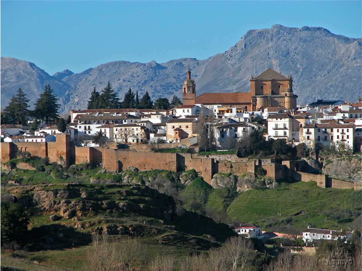
Ronda City Walls & Gates, Citadel (Alcazaba) Walls description & photographs.
The City walls and castle of Ronda as built by the Moors and the location with steep shear cliffs on 2 sides and steep hillside on the other 2 were so strong that they were unbeatable by warfare methods of the age, i.e. bows & arrows and various stone hurling machines.
For years Christian armies had by passed Ronda, knowing that the defensives were too strong.
The introduction of the use of cannon, first used in Europe in, funnily enough used in Spain in the siege of Cordoba only a few years before the siege of Ronda changed the situation.
By miss information the Christian Army had drawn away most of the Moors army to defend Malaga.
Besides bombarding the defensives with canon fire, destroying the octagonal tower in the process, the Christians had also found out about the 'secret' Mine water entrance in the gorge which they attacked and finally captured and thus cut off the Moors from there water supply. Within a few days the Moors had to surrender.
Almocabar Gate and Almocabar Walls Ronda
Almocabar Walls Ronda
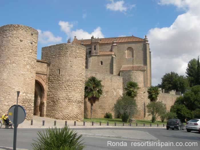
The Almocabar Gate and City Walls in front of The Church of the Holy Spirit
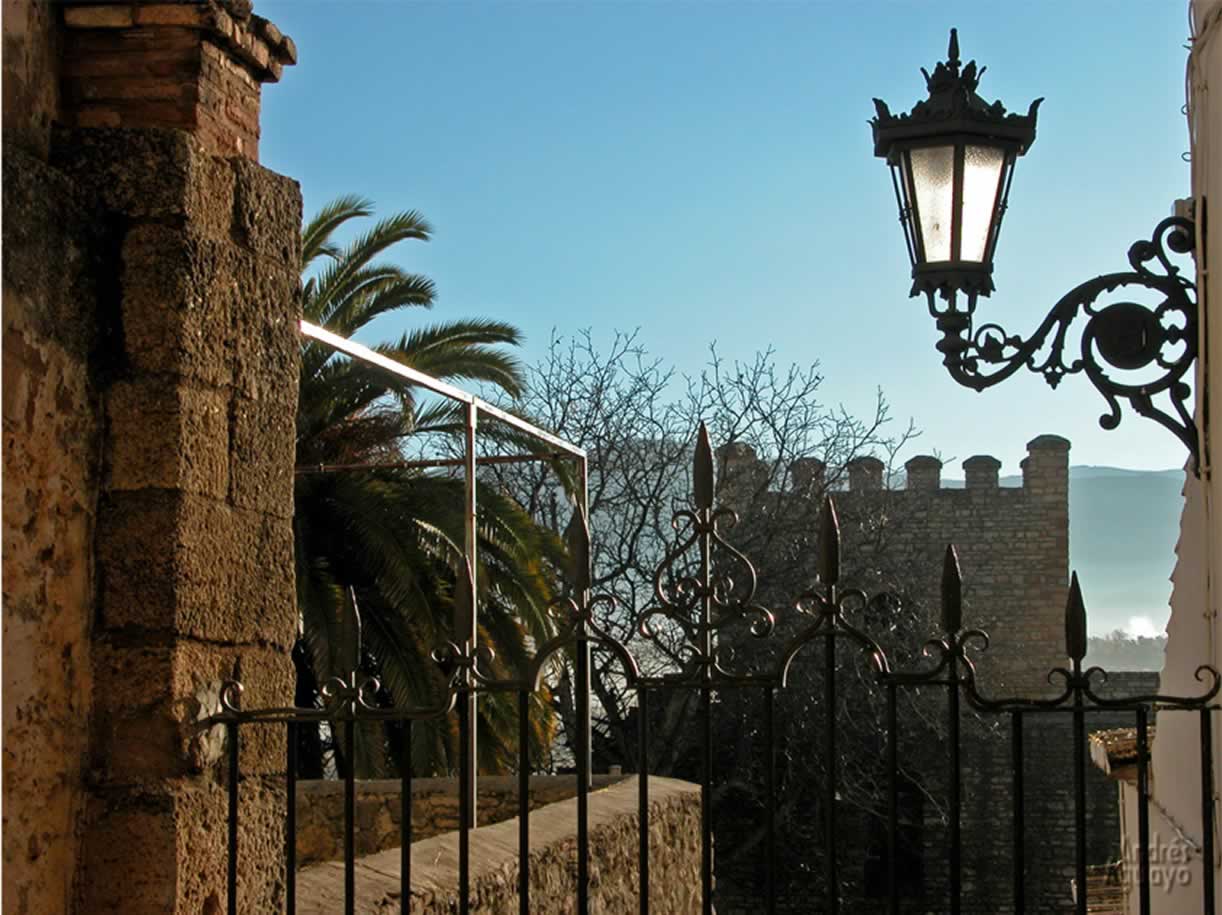
The Almocabar Walls are located on the southern side of Ronda and are well preserved and you can walk along the walls.
It was the main gate leading to the coast. Therefore this is usually the first close up site of Ronda that Tourists from the Costa del Sol see.
Just inside the gate is a small plaza with a bar, cafe & a souvenir shop.
There are 2 roads out of the square:
- Turn right and you can follow the walls along to the rear of the Espiritu Santo Church
- Straight forward and in the narrow road, Calle Espiritu Santo, at number 37 is the Official Tourist Information office and beyond a plaza in front of the Espiritu Santo Church
Just beyond the plaza and the road to the left is a split in the road- on the left leading uphill the road/path with bollards preventing cars leads to the town centre
- on the right the road peters out into a footpath taking you outside the city walls. There are various footpaths outside the walls or lower down is a minor road running parallel to the walls and next to this road are the ruins of the Mid defensive walls.
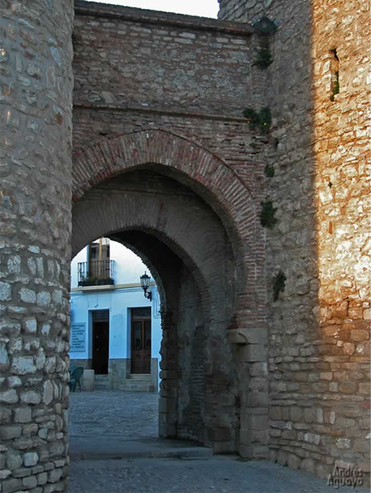
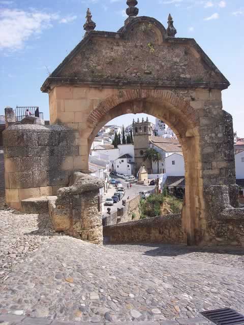
Puerta Almocabar looking into a small plaza inside the walls.
Photo by Tourism of Ronda
The Almocabar gate and Almocabar walls take there name from the Moorish word ‘Al maqabir’ meaning cemetery. By tradition Moorish cemeteries were built outside the city walls and the one at Ronda was located opposite the gate in what is now the Plaza Ruedo Alameda.
Charles V Gate
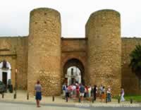
The Charles V Gate is on the extreme left, and on the right a group of tourists with tour guide are outside the Almocabar Gate.
The Charles V Gate was built by Charles V in the 16th century in a renaissance style. Above the arch is a crest containing the Spanish empire eagle on it.
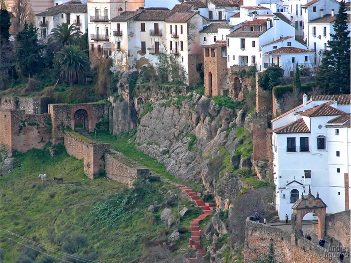
Albacara Walls (Murallas de Albacara)
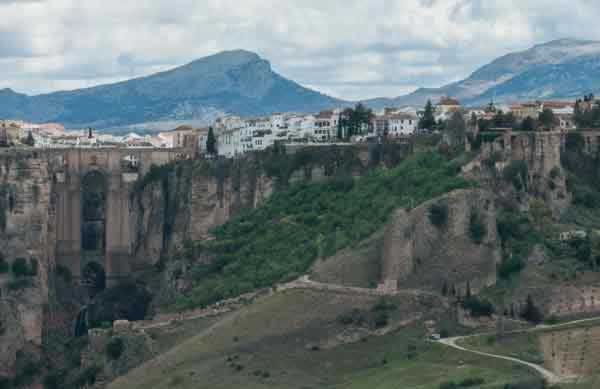
The walls of the Albacara sloping down from just left of centre to lower left.
Ronda's New Bridge in can be seen mid left
Ronda's New Town is behind the bridge & Ronda's Old Town is on the right. Photo by Michal Osmenda
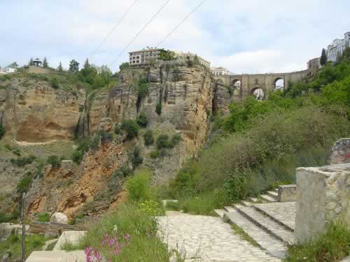
Path into the area near the Albacara Walls in the mouth of Ronda Gorge from the gorge top.
. Photo by Andy Cardiff
The wall is located in the mouth of the gorge roughly half way up the gorge. The wall ends with a shear drop to the gorge bottom and protects a slop that leads right up to the gorge top lip.
There is a footpath up to the Plaza de Maria Auxiliadora in the old town.
The word 'Albacara' comes from the Arabic word 'bab al baqqara' meaning the cattle door.
The Albacara Walls along with shear cliffs protected Ronda
- An area into which cattle could be driven if the town suspected an attack.
- Several very important flour & oil mills were located in the mouth of the gorge behind the wall.
- An outer defence where the hill side was not as steep.
- Restricted entry into the gorge the location of the towns water supply. See the Water mine
Mill Gate (Puerta de los Molinos)
Also called The gate of Christ (Arco del Cristo)

Gate of the Mills (Puerta Molinos)
. Photo by Tourism of Ronda
The Mill gate was near the end of the Albacara Wall next to the gorge edge. It was used for access to the mills further into the gorge mouth.
After the reconquest by the Christians the gate was renamed the Arch of Christ (Arco Cristo) because the Christians built a small shrine into the stonework
Located at the other end of the Albacara Wall built onto a very tall vertical gherkin shaped rock that forms a natural wall.
Levante Walls (Murallas de Levante)
The Levante Walls are located to the East of the Old Town of Ronda (La Ciudad). The Eastern side was a more vulnerable side of the city because the natural defences of high steep cliffs were not present, instead there was a slope in places right up to the walls on the summit, in others up to a small cliff face.
Therefore there was a double line of walls & in places a triple line.
The lines of wall were located:
- Main Wall On top of the hillside rise or hillside rise & short rock cliff face.
- Outer Wall by the side of the road near the valley bottom. This wall runs parallel to the Main Wall. and for quite a length the paved road runs along the top of the wall. To really view this wall it is necessary to take a foot path or side road into the valley bottom fields. The best section is at the end near to the Arab baths
- The third wall is by the Cijara Gate (Puerta de la Cijara) and just to the south of the gate an area know as the Carmen Walls (Murallas del Carmen) where there is an enclosed plaza that is sometimes used for events.
Murallas Arabes Levante. Photo by Tourism of Ronda
East Wall Levante Ronda
Ronda Wall Tower East Wall. Photo by stressbone
Murallas Arabes Tower. Photo by Tourism of Ronda
Cijara Gate (Puerta de la Cijara)
Puerta de la Cijara Ronda. Photo by Tourism of Ronda
The Cijara Gate was located in the Levante Walls and a main entrance into the city. The current short outer wall just before the gate probably extended to other gate(s) no longer visible by the Roman Bridge.
This gate led into the Jewish Quarter.
In the valley bottom below the Cijara Gate is the Arab baths where visitors to Ronda would refresh themselves before entering the city.
Only available on foot
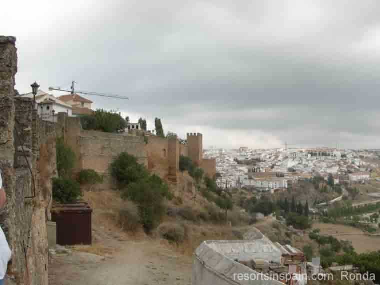
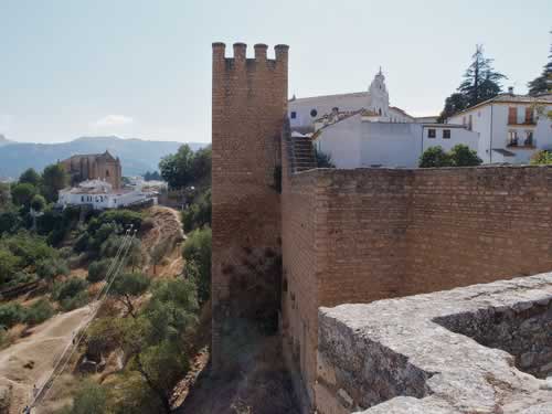
Alcazaba Walls of the Laurel Castle (Castillo del Laurel)
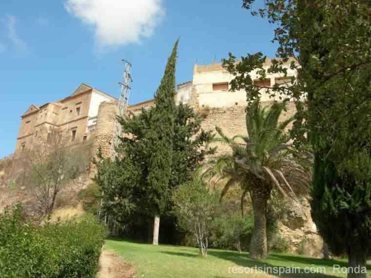
The Impressive Alcazaba Walls
Ronda's Castle, the 'Castillo del Laurel' was built by the Moors on the highest point of Ronda and overlooks, and controls the entrance to the city via the Almocabar Gate and Imágenes Gate no longer in existence.
Philipe V Arch
Philipe V Arch Gateway Ronda Spain. Photo by rosemarydukelow
The Arch of Philipe V was erected in 1742.
The arch replaced a narrow defensive gate built by the Moors in a road improvement scheme and is purely decorative and not defensive.
This was required after after the collapse of the first New Bridge to deal with the traffic from the North
On the arch you will find an inscription and the coats of arms of both the Anjou & Borbons.
There is a nice view of the Padre Jesus Church through the arch.
The Church of the Holy Spirt ( Iglesia del Espiritu Santo)
Church of the Holy Spirt in the location of a previous Moorish defensive tower
The Holy Spirt church was built as a celebration of the Christian victory over the Moors in 1485. The church is built in the location of an octagonal defensive tower built by the moors and it had commanding views of the Almocabar Gate, Almocabar Walls and the approaches to Ronda from the Costa del Sol.
The tower was totally destroyed by the cannon fire of the besieging Christian Army.
Destruction of the Defensive Walls & Gates
The Christian Attack 1485
The armies of Isabella and Ferdinand
laid seige to Ronda for one week. Bombding the Citadel, The Watch tower & other defences to almost total ruins. Still the City withheld the attack.
Defeat occured when the Chrisian Army broke into the lowest fortified chamber of the Water Mne (Mina) thus cutting off the source of water for the city.
The Earthquake of 1580
Destroyed many buildings including parts of the Santa María La Mayor which was under construction that comenced in the late 15th century.
The Peninsular War
The Peninsular War was where Spain & France originally attacked Portugal in 1807. One year later France under Napoleon turned on Spain, who allied itself with Portugal & the United Kingdom. Napaleon was defeated in Spain in 1814 and finally defeated at Waterloo in 1815.
Joseph Bonaparte, the brother of Napoleon Bonaparte,blew up the castle & some other defences on his withdrawel from Ronda in 1812
Road Improvements